Mapping High Mountain Asia Glacier Dynamics with Bistatic Interferometry and SAR Imagery Classification
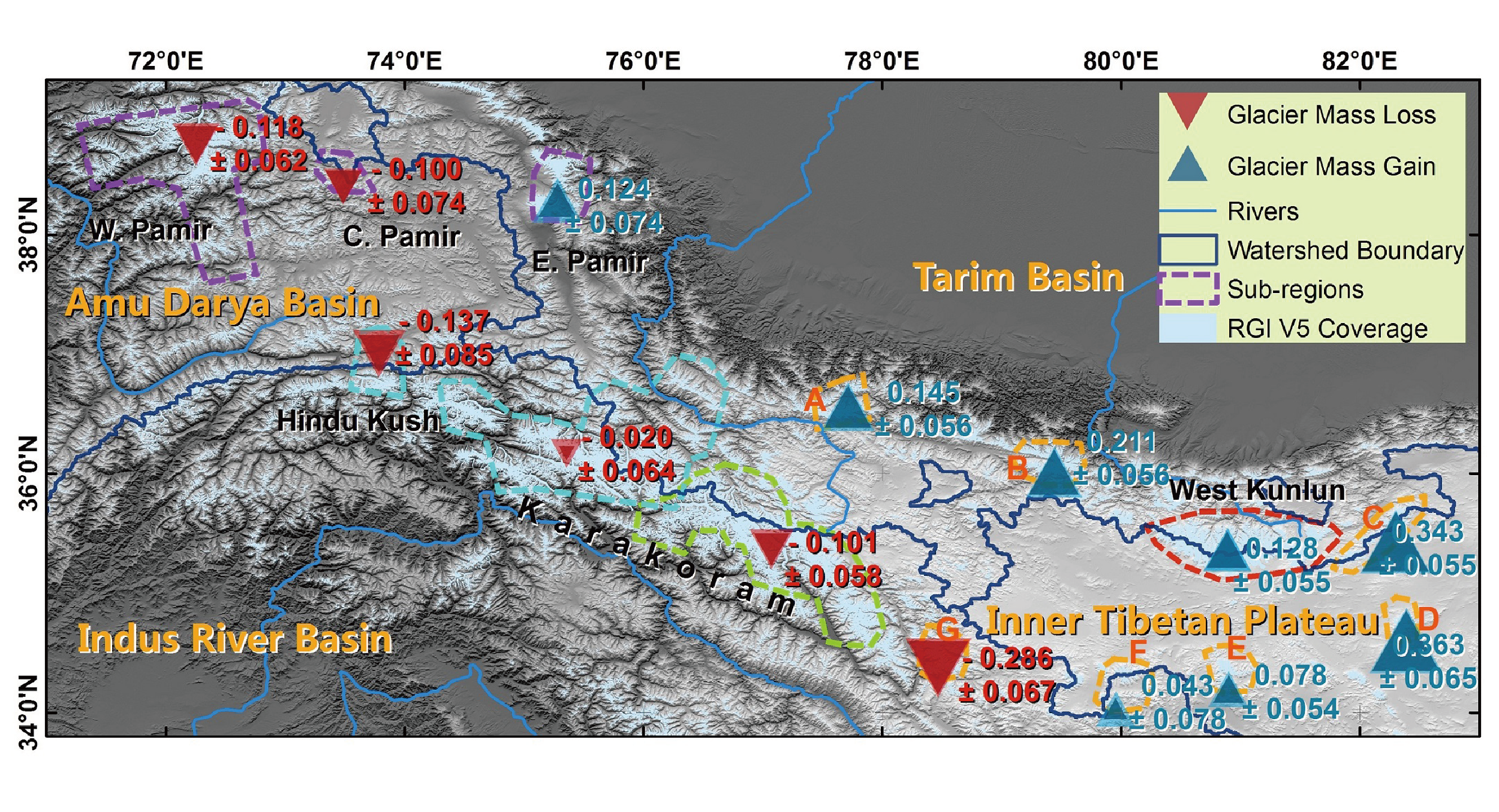
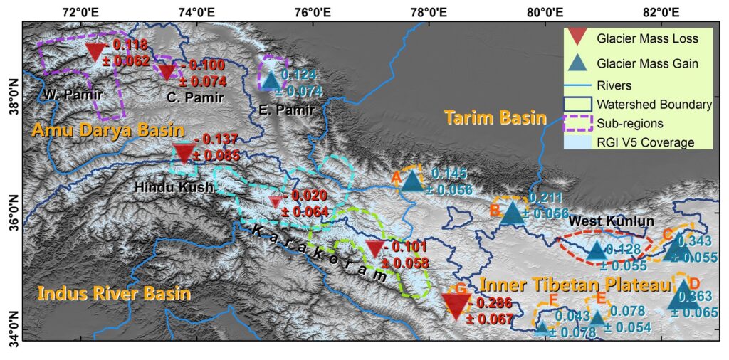
Glaciers, as an important part of the cryosphere, play an essential role in climate change. Their shrinkage is an indicator of global warming. The largest number of low-latitude and high-altitude glaciers in the world are located in ‘High Mountain Asia’ (HMA), including the Tibetan Plateau, the West Kunlun, the Karakoram, the Hindu Kush and Pamir. Due to inaccessibility and high cost, in-situ observations have been performed only on less than 1% of the glaciers in this region. We recently conducted the world’s first large scale glacier mass balance survey based on remote sensing methods in the western part of HMA.
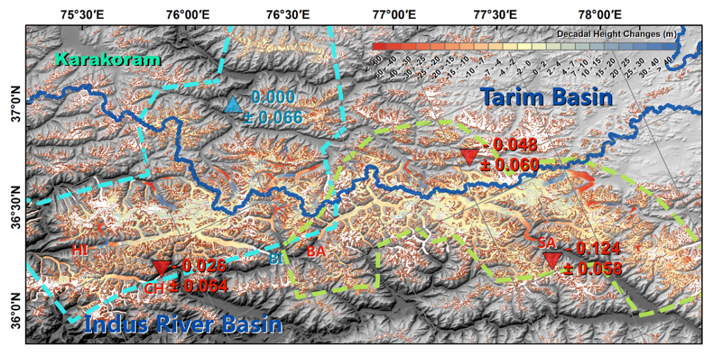
This project applied multi-mission satellite earth observation to invest vast glaciers in HMA. Bistatic synthetic aperture radar (SAR) images are used to form topography and to map decadal glacier height changes by comparing with the terrain data collected in 2000. This research helps scientists understand more about the ‘Karakoram anomaly’. The dataset provides important references for hazard prevention, such as glacier lake outburst flood (GLOF), glacier surging and glacier calving.
- Unlike optical remote sensing which can be affected by clouds and high albedo, radar technique applied in this project is not affected by cloudy weather and also better in observing upper accumulation zones of glaciers which are difficult to observe with optical techniques
- Technique innovated in this project has been applied to other continental glaciers and to form high precision digital elevation models
- Scientific outputs provide essential data for research on regional climate, glaciology, glacial-hydrology researches, and the prevention of glacier-related hazards